This Cold War era map was created to teach Polish troops how to pronounce English place names in the event of an invasion against Britain (click to enlarge).
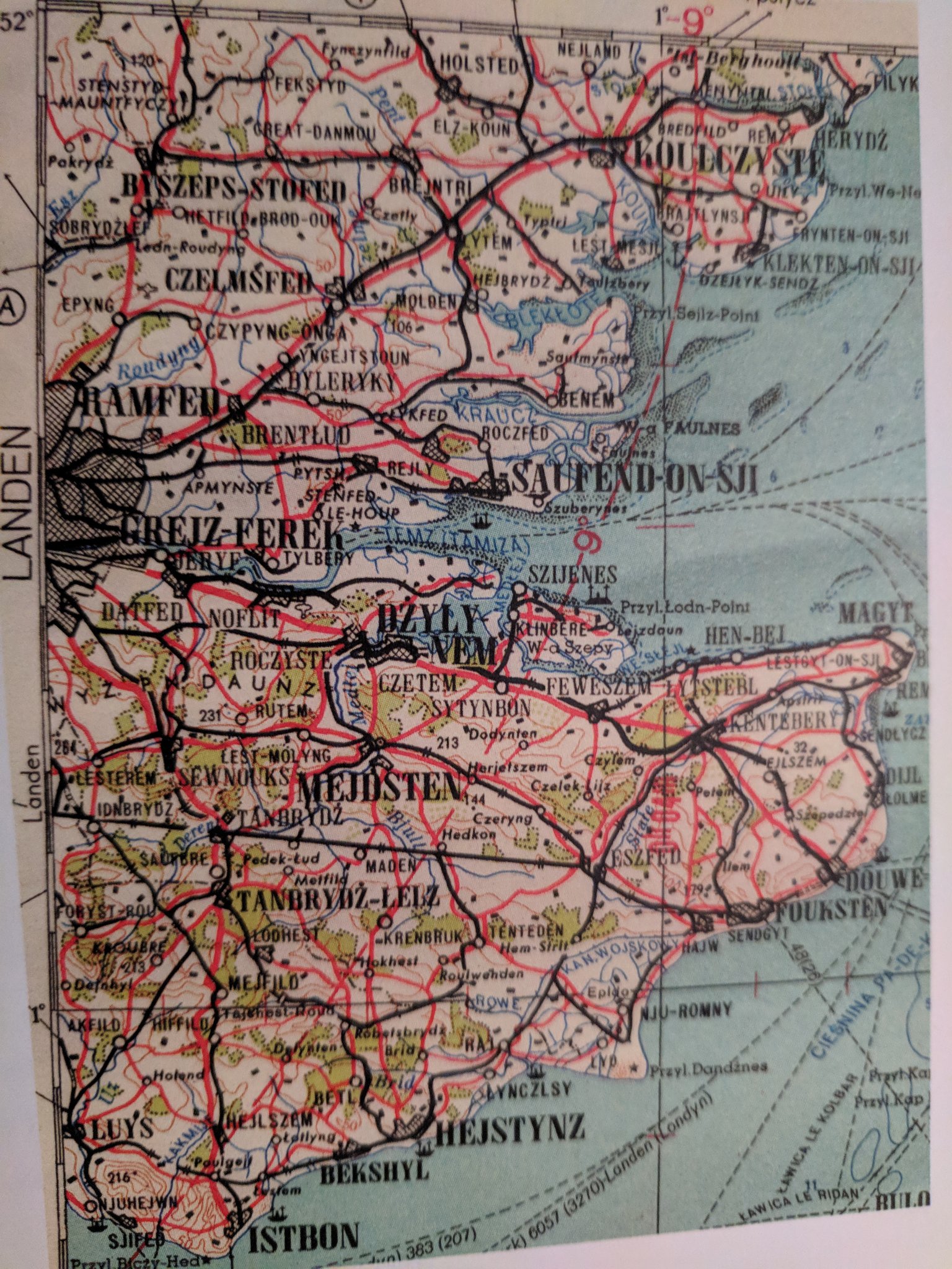
This Cold War-era map was created by Polish intelligence services as part of Warsaw Pact preparations for a potential invasion of the United Kingdom. Designed for Polish troops, it phonetically transliterates English place names into Polish to aid in pronunciation during operations in Britain.
Towns and cities across the southeastern counties like Essex and Kent are re-spelled using Polish phonetics—turning Southend-on-Sea into “Saufend-on-Sji” and Chelmsford into “Czelmsferd”—to ensure soldiers could quickly identify and communicate about British locations without needing to fully master English spelling, which is notoriously irregular.
Beyond its military purpose, the map offers special insight into the mindset and strategies of the Eastern Bloc during the height of Cold War tensions. It reveals how deeply NATO and Warsaw Pact nations were planning for potential full-scale conflict, down to the level of how soldiers would pronounce foreign towns.
 Donate


Related Posts
Finally, a World Map That Gets It Right: The AuthaGraph Projection
Tabula Peutingeriana: The Most Extensive Surviving Map of the Roman Empire Is the Only One to Show Its Vast Road Network
This Is the Oldest Known Map of the World, Made in Babylon About 2,600 Years Ago
Nightmare Fuel Around the World: What “Boogeyman” Looks Like in Different Countries
This Interactive Map Shows You What Native Land You’re Living On
A Tagged Cuckoo Has Made a 50,000-Mile Journey in 5 Years and Just Returned
Cool Maps Reveal The Most Popular Dog Breed in Every Country
Here’s a World Map Centered on New Zealand, Instead of Britain (For a Change)
NASA Satellite Images Show How Much Earth’s Climate Has Changed Recently
Check Out How Your Hometown’s Geography Shifted During Millions of Years With This Interactive Map