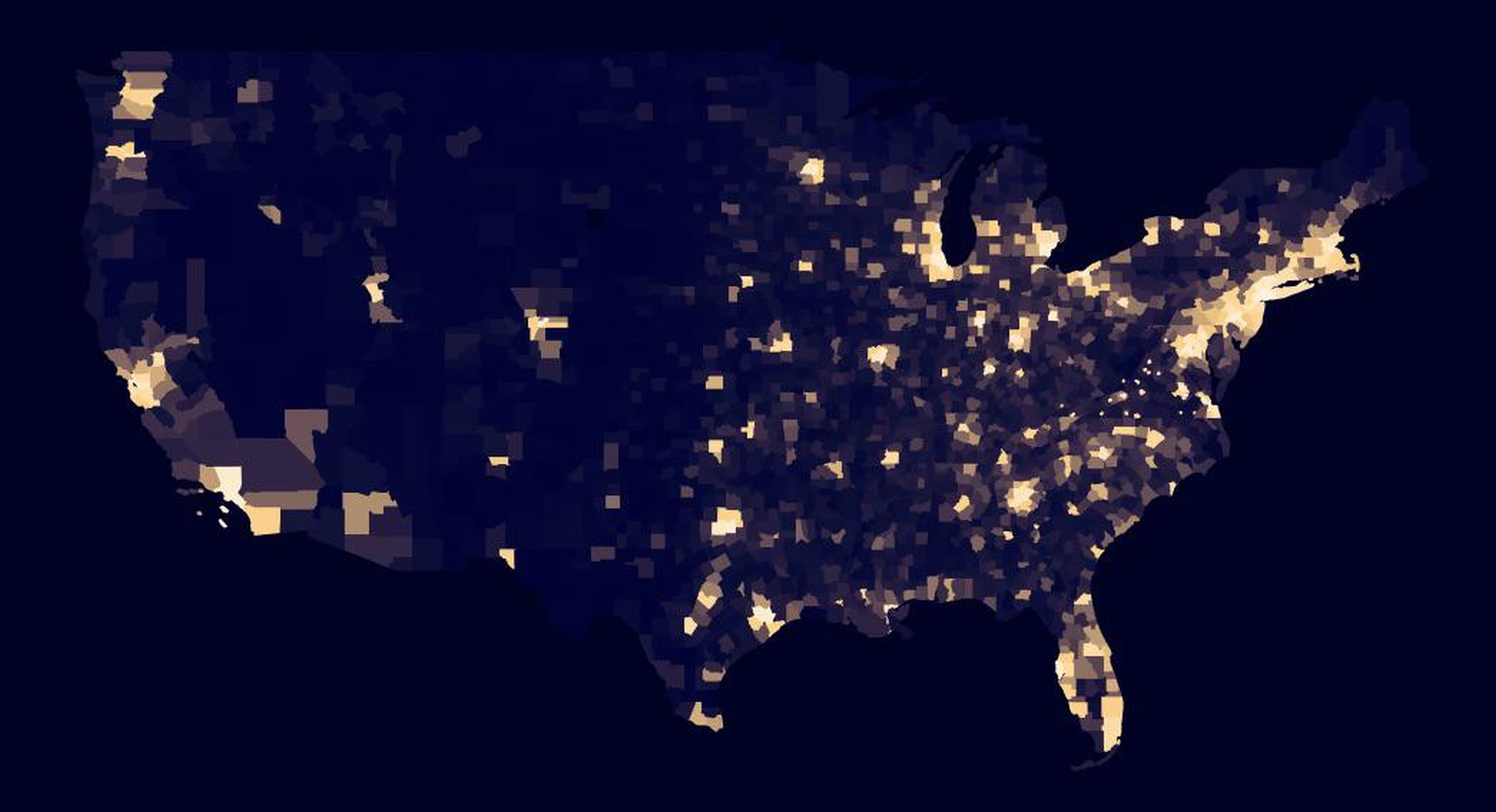
The USA gets empty beyond I-35, as this population density map by Bray Cannon justifies.
Earthly Mission is done by two guys driven by the love for what we are doing. Please kindly consider keeping us going – every bit helps!
 Donate
Check out my other project (especially if you're planning to visit Budapest soon) 👇

Donate
Earthly Mission is done by two guys driven by the love for what we are doing. Please kindly consider keeping us going!
DonateSubscribe
Check out my other project (especially if you're planning to visit Budapest soon) 👇

About Earthly Mission


Related Posts
Finally, a World Map That Gets It Right: The AuthaGraph Projection
Tabula Peutingeriana: The Most Extensive Surviving Map of the Roman Empire Is the Only One to Show Its Vast Road Network
This Is the Oldest Known Map of the World, Made in Babylon About 2,600 Years Ago
Nightmare Fuel Around the World: What “Boogeyman” Looks Like in Different Countries
Rare Wave-Shaped Clouds Captured by Sky-Watcher in Wyoming
Tomorrow Island (Russia) and Yesterday Isle (USA) Are Just Three Miles Apart But There’s a 21-Hour Time Difference Between Them
This Interactive Map Shows You What Native Land You’re Living On
A Tagged Cuckoo Has Made a 50,000-Mile Journey in 5 Years and Just Returned
Cool Maps Reveal The Most Popular Dog Breed in Every Country
Here’s a World Map Centered on New Zealand, Instead of Britain (For a Change)